
When a hurricane begins moving toward land, people want answers fast. Will it turn? Will it weaken? Which areas are most at risk? Meteorologists work to answer those questions by studying huge amounts of weather data and using advanced forecasting tools. Predicting the path of a hurricane is not about guessing. It is a process built on science, experience, and constant updates as the storm changes.
Watching the Storm From the Very Beginning
Meteorologists start by tracking where the storm forms and how it develops. Hurricanes usually begin as tropical disturbances over warm ocean water. Once a system starts organizing, weather experts monitor its position, wind speed, pressure, and structure.
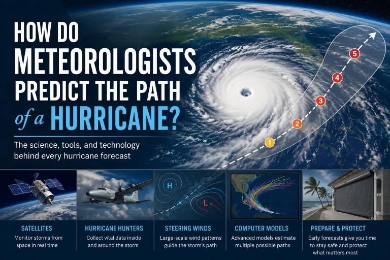
Satellites are one of the most important tools in this process. They provide images of the storm from space and help meteorologists see cloud patterns, storm rotation, and movement over time. With satellite data, forecasters can tell whether a storm is becoming more organized or starting to shift direction. This matters because even a small change early on can affect where the storm may end up days later.
They also look at sea surface temperatures, moisture levels, and wind patterns around the storm. A hurricane does not move on its own in a simple straight line. It is pushed and guided by larger atmospheric conditions around it, especially high and low pressure systems.
Why Wind Patterns Matter So Much
One of the biggest factors in hurricane path prediction is the steering flow. This means the large scale winds in the atmosphere that guide the storm. You can think of a hurricane like an object floating in a moving stream. The storm may have its own strength, but the surrounding winds help determine where it goes.
If a strong high pressure system is in one area, it may push the storm west. If a weakness develops in that system, the hurricane may curve north. If upper level winds shift, the storm may turn out to sea. Meteorologists study these patterns carefully because the path of a hurricane often depends on what is happening far beyond the center of the storm itself.
That is why forecasts can change. The hurricane may still be strong and organized, but if the surrounding weather pattern changes, its track can change too.
Aircraft and Ocean Data Fill in the Gaps
Satellites give a broad picture, but meteorologists also need direct measurements. That is where reconnaissance aircraft come in. These planes, often called Hurricane Hunters, fly into storms to gather data that satellites cannot always capture with enough detail.
They measure wind speed, air pressure, temperature, and humidity inside and around the hurricane. They also release instruments that collect information as they fall through the storm. This gives forecasters a much better idea of the storm’s structure and the conditions influencing its movement.
Buoys, ships, radar, and weather stations also provide useful information. Every piece of data helps meteorologists build a more accurate forecast.
Computer Models Help Forecast the Track
Once meteorologists collect data, they feed it into computer models. These models use physics, mathematics, and past storm behavior to estimate where the hurricane is likely to go. Each model may show a slightly different path based on how it interprets the atmosphere and ocean.
This is why you often see several possible forecast lines on weather maps. Some models may predict a turn to the north, while others show a path farther west. Meteorologists do not rely on one model alone. They compare multiple models, look for trends, and evaluate which ones seem most reliable based on the storm’s current setup.
The official forecast comes from experts who interpret all of that information together. The computer models are extremely important, but human judgment still plays a major role.
Why the Forecast Cone Is Not a Guarantee
A lot of people misunderstand the forecast cone. They assume the hurricane will only affect places directly inside it. That is not how it works. The cone shows the probable path of the center of the storm, but hurricane impacts often reach far outside that area.
Heavy rain, strong winds, tornadoes, and storm surge can hit regions well beyond the center line. That is why residents should not focus only on whether their town sits in the middle of the cone. A hurricane is a large system, and dangerous conditions can spread over a wide area.
Because of that, preparation should start early. As forecasts become clearer, property owners often begin securing vulnerable areas with solutions like hurricane fabric roll down systems that help protect large openings before conditions become unsafe.
Forecasts Improve as the Storm Gets Closer
Hurricane forecasting has improved a lot over the years. Better satellites, stronger models, and faster data collection have made track predictions more accurate than in the past. In general, the closer the storm gets, the more confidence meteorologists have in the forecast path. Still, no forecast is perfect.
Storms can wobble, slow down, speed up, or respond differently than expected to changing weather patterns. That is why official updates matter so much. A forecast from yesterday may not match the forecast today.
For homeowners and businesses in hurricane prone areas, that extra time matters. It gives people a chance to review emergency plans, follow local alerts, and protect important spaces with options like hurricane fabric roll down protection for patios, lanais, and other exposed openings. When a storm track becomes more certain, many people also look into hurricane fabric roll down screens as part of a practical storm readiness strategy.
What This Means for Homeowners
Meteorologists predict the path of a hurricane by combining real time observation, direct storm data, atmospheric analysis, and advanced computer modeling. It is a complex process, but it gives communities the information they need to make smart decisions before landfall.
The most important thing for homeowners is to stay informed and act early. Forecasts are useful because they give you time. And in hurricane season, time is one of the most valuable forms of protection.


